News Summary
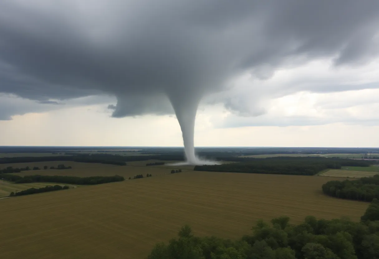
On December 29, 2024, five EF-0 tornadoes hit Upstate South Carolina, with three in Union County and one in Spartanburg County. The tornadoes had peak winds of 80 mph but caused only minor damage and no injuries. Residents are reminded to stay weather-aware in light of this unexpected event. Damage assessments revealed a maximum path width of 50 yards, but overall, the severe weather turned out to be relatively benign.
Weather Shakes Up Upstate South Carolina with Tornadoes!
On a chilly December morning, the usually calm skies over Upstate South Carolina were anything but peaceful. Residents were caught by surprise as the National Weather Service (NWS) confirmed that five EF-0 tornadoes touched down in the area on December 29, 2024. Yes, that’s right! The last Sunday of the year decided to throw a little weather party!
A Closer Look at the Tornadoes
So, where exactly did these tornadoes make their grand entrance? Well, three of them decided to make a splash in Union County. They struck near:
- West Springs
- Monarch Mills
- Union
Meanwhile, one tornado found its way to Spartanburg County, particularly in the Holly Springs area. Exciting—and a bit nerve-racking—don’t you think?
All About the Twisters
The strongest of these tornadoes was rated at EF-0, boasting peak winds of around 80 mph. That’s some serious wind power! This twister was quite the traveler, covering approximately 6.99 miles through the Monarch Mill area. Talk about a road trip!
The other tornadoes were not quite as adventurous, with path lengths ranging from 1.55 miles to 3.24 miles. Residents in impacted areas such as Blackstock Monument, Dixie, and Bethany undoubtedly felt the repercussions of these rapidly swirling winds.
Timing of the Trouble
The turbulence kicked off bright and early, with the first tornado making its debut at 8:15 a.m. near Blackstock Monument. What a way to start the day! But don’t worry too much; on the bright side, all confirmed tornadoes caused only minor damage, and thankfully, no injuries or fatalities were reported. That’s a relief!
Assessing the Damage
Damage surveys were conducted on the following Tuesday after the excitement settled down. The maximum path width for the tornadoes was reported to reach up to 50 yards in places like Bethany and Monarch Mill. It appears that nature had a bit of fun, but nothing too catastrophic!
Stay Weather Aware!
Now, here’s a tip for all you residents in the area: stay weather-aware! The unexpected can happen, and it’s vital to be prepared. Make sure you have access to emergency alerts, so you’re not caught off guard next time Mother Nature decides to show off.
More Information at Your Fingertips
If you’re looking for more details, maps, and reports on these recent tornadoes, don’t hesitate to check out the NWS website. Knowledge is power, after all! And for ongoing updates and related news, follow your local news outlets on social media. They’re often buzzing about the latest happenings.
In conclusion, while tornadoes might send a shiver down your spine, it’s always crucial to remain informed and vigilant. Here’s to hoping the skies stay clear for the rest of the year!
Deeper Dive: News & Info About This Topic
HERE Resources
Severe Weather Outbreak Causes Tornadoes and Tragedies Across Southern States
Severe Weather Warning: Tornado Watches for Georgia and South Carolina
Columbia Under Tornado Watch as Severe Thunderstorms Approach
Storms Devastate Athens, Alabama, Leaving Communities in Ruins
Severe Weather Threat Looms Over Charlotte as Storms Expected this Sunday
Urgent Reminder for South Carolina Residents to Apply for Hurricane Helene Assistance Before January Deadline
Tropical Storm Rafael Poses Potential Rain Threat to Florida as it Moves Through Caribbean
Hurricane Helene Leaves Thousands Without Power in Georgia and South Carolina
Hurricane Helene Approaches: Coastal South Carolina and Southeast North Carolina Brace for Potential Impacts
Hurricane Helene Upgraded to Category 2, Charleston Braces for Gusty Wind and Tornado Threat
Additional Resources
- Fox Carolina: NWS – 3 Tornadoes Reported in Union County Late December
- Google Search: Tornadoes in South Carolina
- Country Herald: 5 Tornadoes Confirmed Across Union, York, and Mecklenburg Counties
- Encyclopedia Britannica: Tornado
- MSN News: NWS – 3 Tornadoes Reported in Union County Late December
- Encyclopedia Britannica: Weather
- 10TV: NWS Tornado Touched Down in Union County
- Google News: Union County Tornado 2024