News Summary
Snow flurries have commenced across the Upstate region of South Carolina and western North Carolina, prompting a Hazardous Weather Outlook from the NWS. While early forecasts suggest light snow and ice accumulations, areas near the North Carolina border may see higher totals. Travel conditions are expected to deteriorate due to slick roads, particularly towards Thursday morning. A Winter Storm Watch has been issued for Friday, warning of additional wintry precipitation. Residents are advised to stay alert for changing weather conditions and potential black ice formations.
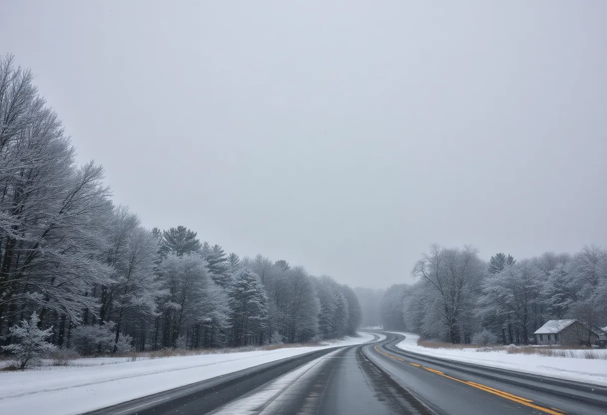
South Carolina – Snow flurries began falling across the Upstate region of South Carolina and western North Carolina on Wednesday morning, creating potential winter weather hazards for residents. The National Weather Service (NWS) had already issued a Hazardous Weather Outlook on Tuesday, indicating that wintry precipitation was likely in the region.
Snow was first noted in downtown Greenville around 11 a.m., followed by Landrum, South Carolina, where flurries started at approximately 10:15 a.m. Early forecasts remain uncertain regarding the extent of snow and ice accumulations in the Upstate area.
According to the NWS, a low-pressure system is expected to generate winter weather north of a line extending from Clayton, Georgia, through Greenville and Spartanburg in South Carolina to Rock Hill and Monroe in North Carolina. Confidence in the predicted snow or ice accumulations is currently low, with totals projected to be light across much of the region.
Forecast and Precipitation Expectations
As for specific accumulations, areas in the northernmost Upstate, particularly near the North Carolina border, are anticipated to receive between a tenth to a couple of tenths of an inch of snow, with York, Chester, and Cherokee Counties particularly affected. There is also a possibility of ice or freezing rain in these locations.
In the Greenville-Spartanburg area, forecasters predict a 80% chance of snow showers before 5 p.m. on Wednesday, followed by a decreasing chance of precipitation to 30% on Wednesday night. Higher elevations are expected to see more significant snowfall, with accumulations ranging from 1 to 3 inches on ridgetops, while valleys in western North Carolina could see mainly under an inch.
Impact on Travel and Weather Alerts
Travel conditions are expected to be hazardous due to slick roads where snow falls. Overnight freezing is likely to exacerbate these conditions, especially Thursday morning as temperatures drop into the teens and 20s. A Winter Storm Watch has also been issued for Friday, signaling additional sleet, snow, and ice accumulations that may contribute to treacherous travel into Saturday.
In Asheville, the forecast calls for possible snow accumulation around half an inch, with total precipitation chances resting at 70% for Wednesday. Snow showers are most likely before 5 p.m., while a 30% chance of rain and snow showers persists until 7 p.m. The NWS anticipates that the weather will clear to partly sunny conditions on Thursday.
Ongoing Weather Developments
Snow showers are expected to sweep into the western mountains and northeast Georgia after 9 a.m., becoming more widespread by noon across the Western Carolinas. Total snowfall for the northern and central areas may reach 1 to 3 inches, while the southern Upstate could see trace amounts up to 2 inches, along with potential ice accumulations up to 0.25 inches.
As Western North Carolina braces for the winter weather, the highest snow totals are projected to be between 3 to 6 inches in the region, under the advisement of a Winter Storm Watch. It is anticipated that snow will cease by early Saturday but may lead to residual snowy and icy conditions on the roads until temperatures begin to rise above freezing.
The region must also be wary of potential black ice forming from lingering moisture or melted snow refreezing Saturday night into Sunday, contingent on daily temperature variations. Residents are encouraged to remain vigilant and prepare for changing weather conditions in the coming days.
Deeper Dive: News & Info About This Topic
- Greenville Online: Snow Forecast for Greenville-Spartanburg
- Wikipedia: Weather Forecasting
- WYFF4: South Carolina & North Carolina Snow
- Google Search: Weather Hazards in South Carolina
- Greenville Journal: Upstate South Carolina Friday Snowfall
- Encyclopedia Britannica: Snow
- Fox Carolina: Mainly Snow with Ice Possible
- Google News: Winter Storm South Carolina
- WLOS: Winter Storm Brings Major Snow
- Google Scholar: Winter Weather Impact Study