News Summary
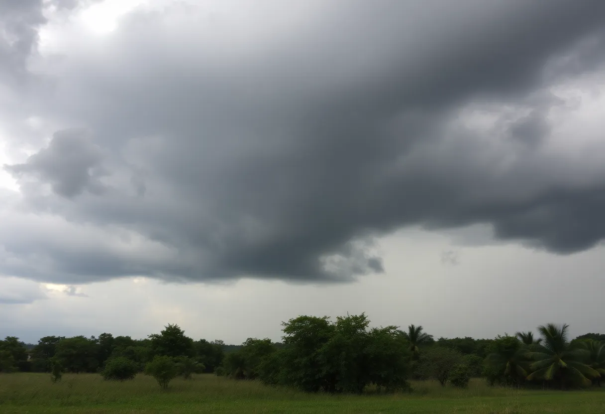
Residents of Georgia and South Carolina are on alert as the National Weather Service has issued tornado watches for several counties, including Bulloch and Bryan. The watch remains active until 1:00 PM EST today, with severe storms expected to hit areas between 3 AM and 8 AM. Authorities urge residents to stay informed and take emergency precautions as the threat of flash flooding and power outages rises due to damaging wind gusts and possible tornado formations. This marks the first major storm event since late September, raising concerns over weather preparedness.
Severe Weather Warning: Tornado Watches Issued for Parts of Georgia and South Carolina
As residents of Statesboro, Georgia, and surrounding areas brace themselves for potentially severe weather, the National Weather Service (NWS) has issued a tornado watch that will be active until 1:00 PM EST today. This watch affects numerous counties, including Bulloch, Bryan, Burke, and several others throughout the region.
Where’s the Storm Heading?
If you’re in Bulloch County, or nearby cities like Savannah and Charleston, it’s time to pay close attention! A robust line of storms is expected to roll across Georgia between the early hours of 3 AM and 8 AM on this fine Sunday morning. Those in areas like Hilton Head Island and Summerville should stay alert for damaging wind gusts and the possibility of brief tornado formations.
Which Areas are Affected?
Here’s a quick rundown on counties under the tornado watch:
- Bryan
- Bulloch
- Burke
- Candler
- Columbia
- Effingham
- Elbert
- Franklin
- Habersham
- Hart
- Jenkins
- Liberty
- Lincoln
- Long
- McIntosh
- McDuffie
- Rabun
- Richmond
- Stephens
- Tattnall
What’s Happening in the Weather World?
This severe weather alert marks the first significant storm event since Hurricane Helene threatened Metro Atlanta back in late September 2024. It’s important to mention that North Georgia has had one of its wettest years on record, currently standing as the 15th wettest year in 2024. This makes the region quite susceptible to severe weather patterns like the ones we’re experiencing.
Prepare and Stay Informed
Residents are strongly urged to stay informed about the latest updates through reliable sources and NOAA Weather Radio. Emergency preparedness measures are being employed, and regular notifications from the NWS will help keep everyone in the loop. It’s essential to remain aware, especially with the risk of flash flooding and scattered power outages that may happen as a result of these storms.
Previous Weather Events
What to Do During Tornado Warnings
During tornado warnings, the best course of action is to find shelter in a basement or an interior room away from windows. Make sure to steer clear of large open spaces and windows to protect yourself from flying debris. It’s also wise to stay off the roads—many drivers and pedestrians have been spotted seeking shelter as conditions worsen.
The Impact of Severe Weather
As of the latest update, nearly 190,000 customers across the South and Southeast are facing power outages. Combine that with the potential for heavy rain, damaging winds, and hail, and you have a serious weather situation on your hands. Stay safe, stay informed, and above all, take care of each other during these unpredictable moments!
Deeper Dive: News & Info About This Topic

Author: STAFF HERE CLINTON
The CLINTON STAFF WRITER represents the experienced team at HEREClinton.com, your go-to source for actionable local news and information in Clinton, Laurens County, and beyond. Specializing in "news you can use," we cover essential topics like product reviews for personal and business needs, local business directories, politics, real estate trends, neighborhood insights, and state news affecting the area—with deep expertise drawn from years of dedicated reporting and strong community input, including local press releases and business updates. We deliver top reporting on high-value events such as the Festival of Discovery, Clinton Community Day, and performances at the Whitten Center Amphitheater. Our coverage extends to key organizations like the Clinton Area Chamber of Commerce and the Laurens County Historical Society, plus leading businesses in manufacturing and education that power the local economy such as Milliken & Company and Presbyterian College. As part of the broader HERE network, including HEREAiken.com, HEREBeaufort.com, HEREChapin.com, HERECharleston.com, HEREClinton.com, HEREColumbia.com, HEREGeorgetown.com, HEREGreenwood.com, HEREGreenville.com, HEREHiltonHead.com, HEREIrmo.com, HEREMyrtleBeach.com, HERENewberry.com, HERERockHill.com, and HERESpartanburg.com, we provide comprehensive, credible insights into South Carolina's dynamic landscape.