News Summary
A severe thunderstorm warning has been issued for Greenville and Laurens counties, valid until 3:30 PM. Residents should prepare for high temperatures, rain, and risks such as quarter-sized hail and strong winds. As the storm approaches, safety measures are crucial. The National Weather Service advises seeking shelter in interior rooms away from windows. Stay informed with local updates to ensure safety during this severe weather event.
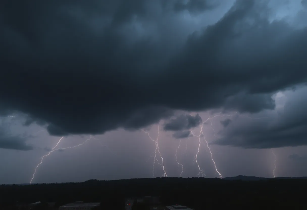
Greenville, SC: Severe Thunderstorm Warning Issued for Greenville and Laurens Counties
Greenville and Laurens counties are under a severe thunderstorm warning, issued by the National Weather Service (NWS) Greenville-Spartanburg at 2:47 PM on Friday. The warning is valid until 3:30 PM, as weather conditions indicate a significant chance of severe thunderstorms accompanied by rain showers throughout the day and into the night.
Today’s weather forecast predicts high temperatures reaching 78°F, with partly cloudy skies, and a 50% chance of rain during the day. South-southwest winds are expected to range from 10 to 15 mph. However, a shift in weather is anticipated overnight, with thunderstorms becoming more widespread and a 90% chance of rain as the temperature drops to a low of 58°F. Wind speeds will decrease to between 5 to 10 mph overnight.
As the severe thunderstorm moves through, reports indicate the storm is currently located approximately 13 miles south of Downtown Greenville, moving east at a speed of 15 mph. Associated risks include quarter-sized hail (approximately 1 inch) and wind gusts reaching up to 60 mph. The areas significantly affected by this severe thunderstorm warning include Fork Shoals, Princeton, Gray Court, Fountain Inn, Hickory Tavern, Simpsonville, and Donaldson Center.
Residents are urged to prioritize their safety by adhering to the NWS’s recommendations, which include moving to an interior room on the lowest floor of residences or buildings and avoiding windows. Additionally, the NWS emphasizes that lightning poses a significant threat during thunderstorms, and individuals should take caution as the risk of lightning strike increases with proximity—the guideline being, if thunder can be heard, individuals are close enough to be at risk.
Previous Weather Alerts
Earlier this week, another weather alert was issued on Thursday at 2:07 PM for strong thunderstorms affecting Laurens and Greenwood counties until 2:45 PM. This alert noted the potential for pea-sized hail (about 0.25 inches) and wind gusts of up to 40 mph, impacting more localized areas including Coronaca, Cross Hill, and Greenwood State Park.
Safety Tips and Risks
The NWS has also shared important safety tips regarding thunderstorms. It is crucial to seek shelter indoors whenever possible, particularly during severe weather events. The risk of hydroplaning, which occurs when vehicles slide uncontrollably on wet roads due to water build-up in front of tires, is a significant concern during rainy conditions. Drivers are encouraged to remain vigilant and adjust their driving behaviors accordingly during inclement weather.
National Weather Service data highlights that thunderstorms can lead to numerous casualties each year, with around 25 million lightning strikes occurring across the United States annually, resulting in approximately 20 fatalities annually. This underscores the importance of taking weather alerts seriously and adhering to suggested safety precautions.
Conclusion
As the severe thunderstorm warning continues to unfold, residents in Greenville and Laurens counties are advised to remain informed and cautious. Monitoring local weather updates and adhering to safety guidelines can help ensure the well-being of individuals during this potentially dangerous weather event.
Deeper Dive: News & Info About This Topic
HERE Resources
Spring Showers and Storms Expected in Colorado City
Severe Thunderstorm Alerts Issued for Laurens and Greenwood Counties
Tragic Loss: Community Mourns 9-Year-Old Boy Swept Away by Floods
State of Emergency in South Carolina: Winter Storm Approaches
Severe Weather Hits Columbia: Tornado and Thunderstorm Warnings
Severe Weather Hits Michigan: Thunderstorms and Ice Damage
Severe Weather Warnings Issued for Columbia and Lexington Counties
Severe Thunderstorms Cause Ruckus Across Western Washington
Severe Thunderstorm and Tornado Warnings Hit Columbia, SC
Severe Thunderstorm and Tornado Warnings Hit Columbia
Additional Resources
- Herald Online: Severe Thunderstorm Warning
- Wikipedia: Thunderstorm
- Myrtle Beach Online: Weather News
- Google Search: Severe Thunderstorm Warning
- KOAA: Storm Safe Visits
- Google Scholar: Thunderstorm Safety
- CBS News: Weather Forecast
- Encyclopedia Britannica: Thunderstorm
- NBC 26: Weather Forecast
- Google News: Thunderstorm Alerts