News Summary
Residents of Laurens and Greenwood Counties in South Carolina are under severe thunderstorm alerts, as issued by the National Weather Service. Expect penny-sized hail and strong winds, with the storm moving east at 25 mph. Areas such as Coronaca, Cross Hill, and Lake Greenwood State Park are advised to seek shelter. Additional alerts have been issued for Chester County, where nickel-sized hail is anticipated. Hydroplaning poses a significant risk for drivers. Meteorologists forecast continuing storms into the weekend, bringing potential tornado risks and damaging winds.
Severe Thunderstorm Alerts Hit Laurens and Greenwood Counties in South Carolina
Attention residents of Laurens and Greenwood Counties! Grab your umbrellas and heed this weather alert: strong thunderstorms are rolling through the area! The National Weather Service (NWS) Greenville-Spartanburg issued an updated alert at 4:14 p.m. on Friday, warning of these potentially wild conditions expected to last until 5 p.m..
What to Expect
These thunderstorms mean business! Expect penny-sized hail, measuring up to 0.75 inches, which could cause some minor damage to outdoor belongings. Doppler radar has spotted these storms forming along a line stretching from 4 miles northwest of Greenwood to a point about 11 miles southeast of Abbeville. If you’re in the path of these storms, they’re moving east at a brisk pace of 25 mph.
Areas that will be experiencing the brunt of this storm include neighborhoods and parks like Coronaca, Cross Hill, Lake Greenwood State Park, Bradley, Cokesbury, Ninety Six Historic Site, and Kirksey. If you’re outside during this storm, the NWS advises you to quickly seek shelter indoors to stay safe from the elements!
More Thunderstorm Alerts
Just a little earlier, an alert was also issued at 3:24 p.m. for Chester County, also under the threat of severe thunderstorms until 4 p.m.. Residents there should be on the lookout for nickel-sized hail measuring 0.88 inches. The storm was tracked from 8 miles south of Rock Hill to about 9 miles south of Chester, moving faster at 40 mph. If you’re in Richburg, Cornwell, or Fort Lawn, it’s best to get inside!
Hydroplaning: A Major Risk
With all this rain, be cautious while driving! Hydroplaning can turn your car ride into a scary situation if you hit a wet road. It happens when water builds up in front of your tires, causing your vehicle to lose traction and slide uncontrollably. It’s important to slow down if you notice rain starting to fall, and always drive with care.
What’s Next?
Looking ahead, the storm system isn’t done with us yet! Meteorologists are forecasting that the region will be affected again from Saturday evening into Sunday. Prepare for heavy rain, strong winds, and potentially damaging storms, including the risk of tornadoes! The NWS is zeroing in on windy conditions with gusts from 35-50 mph across the North Carolina mountains, and 25-35 mph elsewhere.
Scenes in the Greenville area could highlight the dangers of severe weather, including strong winds, large hail, and the risk of tornadoes. The primary concerns with these storms moving forward are damaging wind gusts, tornado formations, and large hailstorms, so it’s essential to remain vigilant.
Preparedness Matters
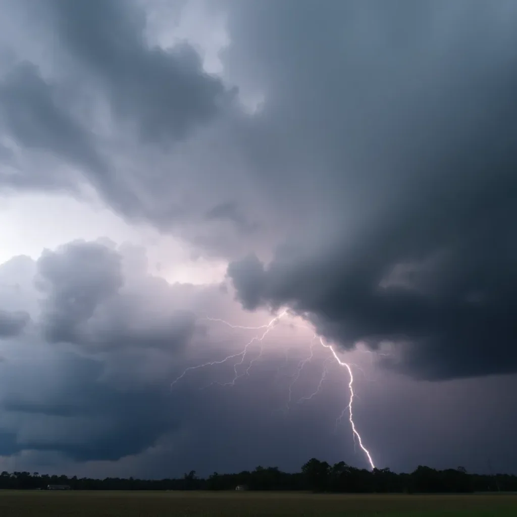
As we experience these ongoing storms, keep in mind that the risk of lightning goes up significantly as the storm creeps closer, peaking when it’s directly overhead. Each year, lightning strikes the United States around 25 million times during the summer months alone. Unfortunately, around 20 fatalities occur due to lightning strikes annually, so remember to stay indoors when storms approach.
Stay safe out there, folks! Keep an eye on the skies, be prepared for changing weather, and most importantly, stay indoors when storms hit hard!
Deeper Dive: News & Info About This Topic
HERE Resources
Weather Alerts and Local Events for Upstate Residents
State of Emergency in South Carolina: Winter Storm Approaches
Severe Weather Hits Columbia: Tornado and Thunderstorm Warnings
Tragic Incident in Greenville: Young Woman Shot by Deputies
Deadly Storm System Devastates Midwest and Southeast
Severe Weather Warnings Issued for Columbia and Lexington Counties
Severe Thunderstorms Cause Ruckus Across Western Washington
Severe Thunderstorm and Tornado Warnings Issued in Columbia, SC
Severe Weather Alerts Across Central U.S. as Spring Storm Arrives
Severe Weather Causes Havoc Across Multiple States
Additional Resources
- Island Packet: Severe Weather Alert
- Wikipedia: Severe Thunderstorm
- The State: Weather Update
- Google Search: Severe Weather in South Carolina
- Fox Carolina: First Alert Weather
- Encyclopedia Britannica: Severe Weather
- Greenville Online: Tornado Outlook
- Google News: Tornadoes in Greenville