Laurens, Union, and Spartanburg Counties, September 21, 2025
News Summary
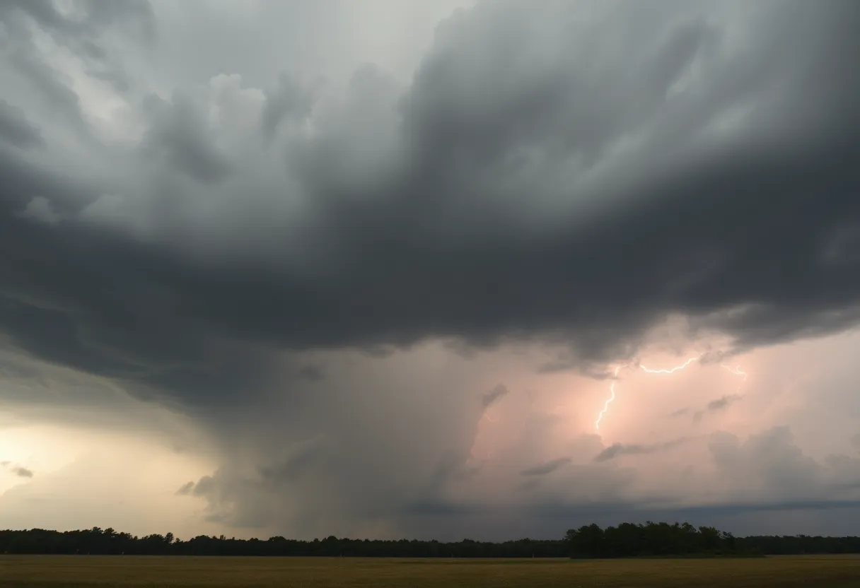
The National Weather Service has issued a severe thunderstorm alert for Laurens, Union, and Spartanburg counties. Residents should prepare for hazardous weather, including wind gusts up to 40 mph and penny-sized hail. The storm could lead to localized flooding and possible damage to outdoor objects. Drivers are advised to avoid flooded roadways.
Severe Thunderstorm Alert in Laurens, Union, and Spartanburg Counties
A severe thunderstorm alert has been issued by the National Weather Service (NWS) for Laurens, Union, and Spartanburg counties, effective until 6:45 p.m. on Saturday. Residents are advised to prepare for potentially hazardous weather, including strong winds and hail.
The NWS report, released at 6:06 p.m., indicates that the storm may bring wind gusts reaching up to 40 mph and hailstones about the size of pennies, measuring approximately 0.75 inches in diameter. As of 6:05 p.m., Doppler radar identified a strong thunderstorm located 7 miles east of Laurens, near Clinton, moving northwest at a speed of 25 mph.
Expect gusty winds capable of knocking down tree limbs and tossing unsecured items. Minor hail damage to outdoor objects is also a possibility due to the storm. Communities likely to be affected include Laurens, Clinton, Joanna, Buffalo, Gray Court, Rose Hill State Park, Cross Keys, Cross Anchor, Sedalia, and Enoree.
Accompanying the storm, torrential rainfall could lead to localized flooding in vulnerable areas. The NWS specifically cautions drivers to avoid traversing flooded roadways during the storm to ensure their safety.
The thunderstorm alert will remain active until 6:45 p.m., and residents are urged to stay vigilant as the storm approaches.
Understanding Thunderstorm Dangers
In the U.S., it’s reported that approximately 25 million lightning strikes occur each year, predominantly during summer months. These strikes result in an average of 20 fatalities annually, underscoring the dangers involved with thunderstorms. The likelihood of being struck by lightning escalates as a storm approaches, reaches its peak during the storm, and reduces once the storm has passed.
Hydroplaning Explained
Drivers should also be aware of the risk of hydroplaning—a dangerous condition where a vehicle loses contact with the road due to water buildup in front of the tires. This phenomenon occurs when a vehicle’s weight cannot displace the water quickly enough, causing the tires to slide uncontrollably on wet roads. It’s essential for drivers to understand how to navigate such situations safely.
Safety Recommendations
The National Weather Service has issued several safety tips for navigating thunderstorms effectively. Staying indoors, avoiding contact with electrical appliances, and maintaining safe driving practices during adverse weather conditions are vital for ensuring personal safety.
This alert serves to remind the public of the potential dangers associated with severe thunderstorms and the importance of preparedness in such situations.
FAQs
What was issued for Laurens, Union, and Spartanburg counties on Saturday?
A severe thunderstorm alert was issued by the National Weather Service for Laurens, Union, and Spartanburg counties.
When is the alert effective until?
The alert is effective until 6:45 p.m.
What storm conditions are expected?
Expected storm conditions include wind gusts up to 40 mph and penny-sized hail measuring 0.75 inches.
Where was the storm tracked at 6:05 p.m.?
A strong thunderstorm was located 7 miles east of Laurens, near Clinton, moving northwest at 25 mph.
What damage could result from the storm?
Gusty winds could knock down tree limbs and blow around unsecured objects, while minor hail damage to outdoor objects may occur.
Which locations will be impacted by the alert?
Locations impacted include Laurens, Clinton, Joanna, Buffalo, Gray Court, Rose Hill State Park, Cross Keys, Cross Anchor, Sedalia, and Enoree.
What does the NWS warn regarding rainfall?
The NWS warns of torrential rainfall accompanying the storm, which may lead to localized flooding.
What should drivers do during the storm?
Drivers are advised not to drive through flooded roadways during the storm.
Key Features of the Thunderstorm Alert
| Feature | Details |
|---|---|
| Issued By | National Weather Service |
| Effective Until | 6:45 p.m. on Saturday |
| Wind Gusts | Up to 40 mph |
| Hail Size | Penny-sized (0.75 inches) |
| Storm Location | 7 miles east of Laurens, near Clinton |
| Communities Affected | Laurens, Clinton, Joanna, Buffalo, Gray Court, Rose Hill State Park, Cross Keys, Cross Anchor, Sedalia, Enoree |
| Risk of Flooding | Localized flooding possible |
Deeper Dive: News & Info About This Topic
HERE Resources
Laurens County Crime Report Highlights Rising Arrests
Massive Haboob Dust Storm Hits Arizona – Visibility Reduced
Severe Thunderstorm Warnings Issued for Saranac and Surrounding Areas
Man Charged with Murder in Clinton Shooting Incident
Severe Thunderstorm Watch Issued for Carolinas
Bridge Repair Project Public Meeting Scheduled
Teen Shot at Graduation Party in Laurens County
Severe Thunderstorm Warnings Issued for Upstate South Carolina
Severe Thunderstorms Rock the Western Carolinas
Severe Thunderstorms Forecasted for Upstate South Carolina
Additional Resources
- Herald Online: Severe Thunderstorm Alert
- Wikipedia: Thunderstorm
- The State: Weather News
- Google Search: Thunderstorm Safety
- Greenville Online: Severe Thunderstorm Warning
- Google Scholar: Thunderstorm Alerts
- Encyclopedia Britannica: Thunderstorm
- WBTV: Severe Thunderstorm Warning