News Summary
The National Weather Service has issued severe weather alerts for the Midlands, particularly affecting Newberry and Fairfield counties. Residents should be ready for strong thunderstorms, possible hail, high wind gusts, and a tornado watch in various counties. Safety steps include seeking indoor shelter during storms, avoiding travel during heavy rains, and securing outdoor items. The storm system is expected to intensify early Wednesday morning with potential gusts up to 75 mph, and residents are urged to prepare for the severe weather and take necessary precautions.
Storm Alerts in the Midlands: Prepare for Severe Weather!
As residents of the Midlands brace for some serious weather, the National Weather Service (NWS) in Columbia, South Carolina has issued a weather alert early Saturday morning. Starting at 9:04 a.m., strong thunderstorms are on the way, with warnings set to last until 9:45 a.m. in both Newberry and Fairfield counties. So, if you live in these areas, it’s time to pay attention!
What You Need to Know
The alert comes with a heads-up about possible pea-sized hail (about 0.25 inches) and wind gusts that could blast their way up to 50 mph. That’s strong enough to knock down tree limbs and send unsecured objects flying around—a recipe for minor damage, for sure!
Doppler radar has been tracking a robust thunderstorm located near Clinton, just 13 miles east of Laurens. This storm is moving east at a brisk pace of 40 mph, and the NWS suggests that folks in the following hotspots should prepare:
- Whitmire
- Blair
- Maybington Fire Station
- US-176
- SC-34 Crossroads
- Feasterville Fire Station
- Henderson Island
- Enoree Ranger District Office
- Kinards
- Interstate 26 between mile markers 62 and 67
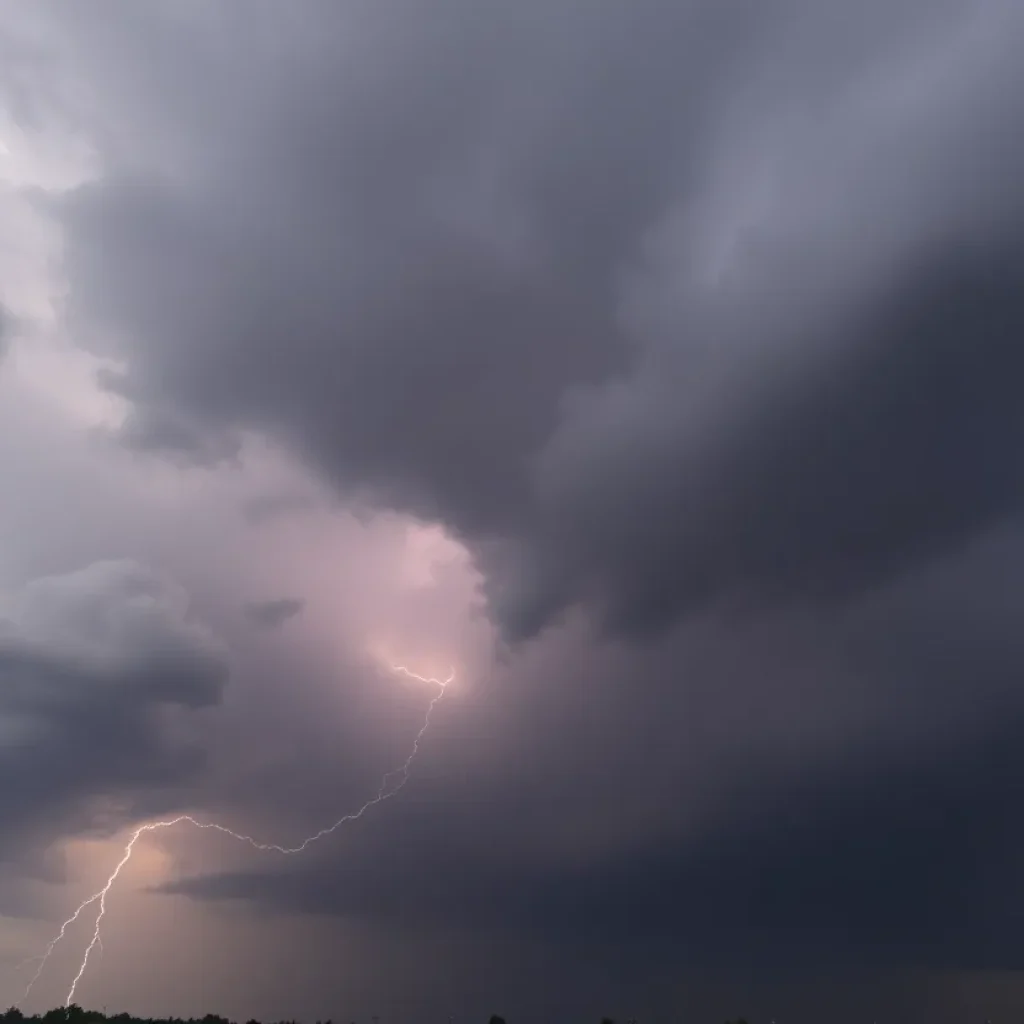
For anyone who’s outdoors when these storms hit, the best advice is to seek indoor shelter as quickly as possible. The risk of lightning strikes significantly increases as storms approach and peaks when you are right underneath them, with lightning striking the U.S. around 25 million times annually. That can lead to about 20 fatalities each year. Let’s try to keep the numbers down!
Travel Hazards Ahead
It’s also important to watch the roads. When heavy rains hit, the conditions can lead to hydroplaning—that slippery situation when your car glides uncontrollably over water. It’s essential for drivers to stay cautious, especially during the morning commute when storm conditions will be most intense.
And if that’s not enough, the NWS has issued a tornado watch for a variety of counties, including Calhoun, Chesterfield, Lee, and more, extending until 1 p.m. Tornado warnings were also given earlier for areas like Columbia and Lexington.
Keep Yourself Protected!
Residents are advised to prepare for a storm system expected to roll into the Midlands early Wednesday morning, with the most critical hours between 5 a.m. and 1 p.m.. It’s projected that some areas could experience wind gusts reaching between 60 and 75 mph. This could lead to downed trees, power lines, and resulting scattered power outages—definitely not a fun situation, right?
While the chance of tornado warnings is low, it’s notable enough for us to keep a close watch on developing conditions across the eastern Midlands and the Pee Dee region.
What Can You Do?
During such unpredictable weather, it’s wise to take action. Make sure to charge your devices, stay in the loop via news apps, and secure any outdoor items that could turn into projectiles. If you have planned any outdoor burning, best to postpone as a statewide burn ban has already been declared due to the increased risk of fires from dry conditions and strong winds.
With this storm system approaching, the time to prepare is now. Stay safe, stay informed, and let’s weather this together!
Deeper Dive: News & Info About This Topic
HERE Resources
Severe Thunderstorm Warnings Affect Laurens Area
Severe Thunderstorm Warnings Issued for Laurens and Union Counties
South Carolina Prepares for Major Winter Weather Event
Severe Winter Weather Forecasted for South Carolina
Severe Thunderstorm Warning in Laurens County, SC
Severe Thunderstorm Warnings Issued for Midlands Residents
Severe Thunderstorm Warning for Greenville and Laurens Counties
West Main Street in Laurens to Undergo Major Construction
Wildfires Rage in the Carolinas: Evacuations and Emergency Declared
Winter Weather Advisory: Columbia, SC Prepares for Wintry Conditions
Additional Resources
- ABC Columbia
- Wikipedia: Severe Weather
- WLTX
- Google Search: Severe Weather South Carolina
- The State
- Google Scholar: Severe Weather Preparedness
- Herald Online
- Encyclopedia Britannica: Weather Safety
- Island Packet
- Google News: South Carolina Weather Alerts