News Summary
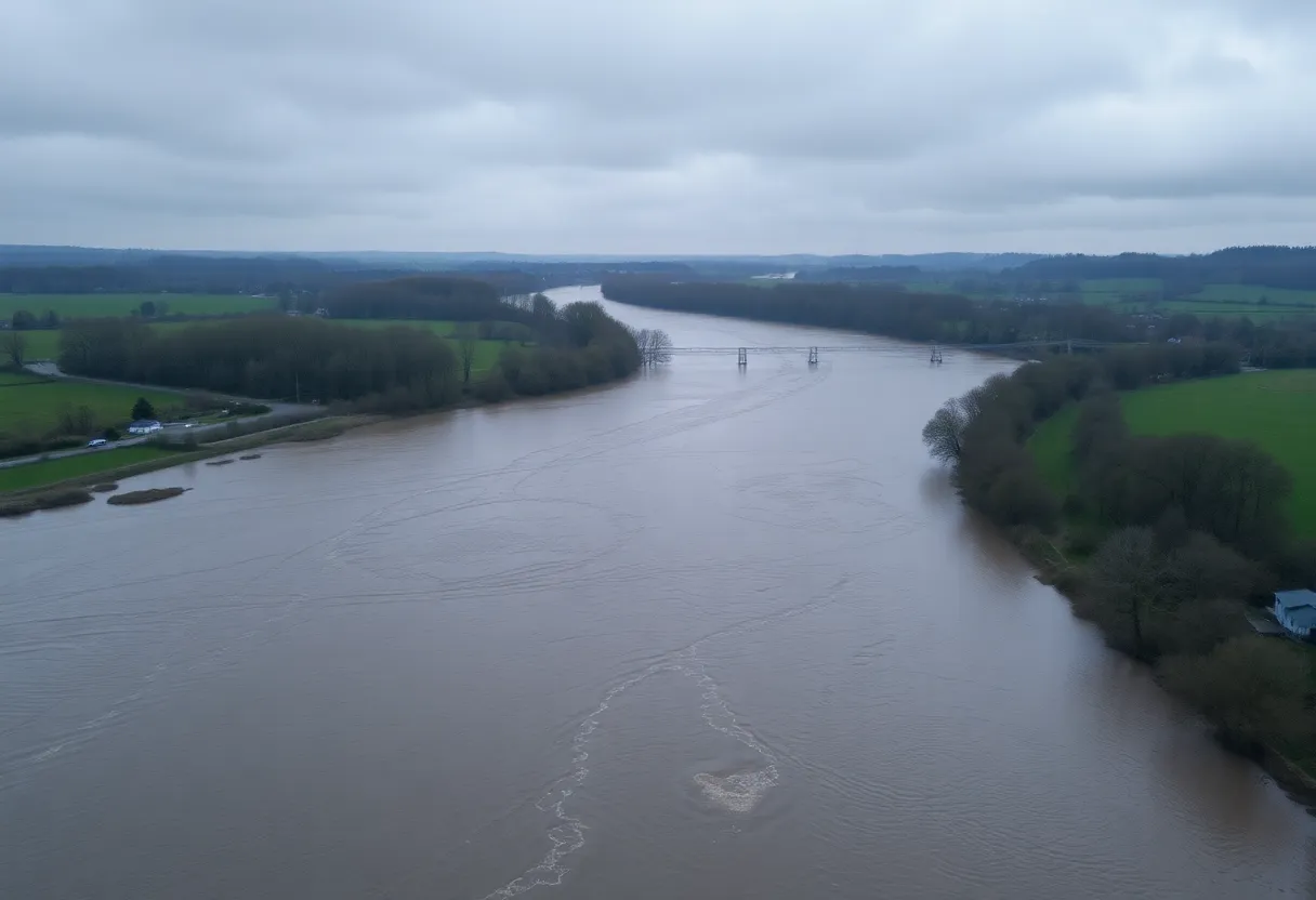
Residents of Greenwood and Newberry counties are being urged to stay safe as the National Weather Service has issued a flood warning due to rising levels of the Saluda River. Minor flooding is expected, particularly at Chappells, and caution is advised for those in flood-prone areas. It is crucial to avoid driving through flooded roadways, heed evacuation orders, and monitor conditions closely. The warning is in effect until Monday at 1 a.m., and updates will be provided throughout the day.
Flood Alert for Greenwood and Newberry Counties: Stay Safe!
Good morning, residents of Greenwood and Newberry counties! We’re here to bring you some important news as the National Weather Service has just issued an updated flood warning in our area early this morning. The warning took effect at 1:21 a.m. today and is something everyone living or working near the Saluda River should pay close attention to. So, grab your morning coffee, sit tight, and let’s dive into what this means for you.
What’s Happening?
As the Saluda River continues to rise, minor flooding is forecasted especially at Chappells. It’s important to note that flooding starts when the river hits 14.0 feet, affecting the lowlands nearby and downstream. With the rain we’ve experienced lately, this is a situation that could escalate quickly, so it’s best to be prepared. If you have any cattle grazing on river bottomland, now is the time to consider moving them to higher ground.
Your Safety Is Priority!
Something crucial that the National Weather Service wants to highlight is that most flooding deaths occur in vehicles. This serves as a serious reminder: never drive through flooded roadways or around barricades! It could be tempting to take a shortcut through a “puddle,” but that water could be much deeper than it looks. Flooded roads are not just inconvenient; they can be deadly.
What Should You Do?
If you live or have any activities planned near the river, please keep an eye on those rising water levels. It’s essential to prepare yourself and take action if necessary. The warning is currently in effect until Monday at 1 a.m., so time is of the essence. The National Weather Service will provide an update at 1:30 p.m. today, so stay tuned!
Evacuation Tips
For those who find themselves in flood-prone areas like campsites or low-lying neighborhoods, now is the time to seek higher ground. If you receive any evacuation instructions, follow them without delay. It’s sensible to lock your home up securely and, if possible, disconnect utilities to avoid any damage.
Also, be very cautious of anything electrical when flooding occurs. Stay away from submerged electrical outlets or cords. And if you hear any electrical sparks or sounds, don’t hesitate—evacuate immediately!
Be Aware of the Dangers!
It’s crucial not to step into water that might be electrically charged or walk through floodwaters. Keep in mind that even 6 inches of moving water can knock you off your feet, and 12 inches can sweep away most vehicles. Hydroplaning can also occur when water builds up in front of your tires; this is when you lose control, so please drive extra carefully!
In Case of Emergency
If you ever find yourself trapped by fast-moving water, seek the highest point you can find and contact emergency services right away—dial 911 for help.
Keep Monitoring Conditions!
Heavy rainfall can quickly lead to dangerous flooding, especially in those low-lying areas we’re all familiar with. As you go about your day, stay informed about the weather and be prepared to act if conditions worsen. The well-being of you and your loved ones is the top priority, so let’s work together to stay safe!
Stay dry, stay safe, and let’s all keep an eye on the weather. We’ll keep you updated as we learn more about this evolving situation.
Deeper Dive: News & Info About This Topic
HERE Resources
Brace For the Chill: Polar Vortex Hits the U.S.
Severe Weather Hits Eastern U.S. with Floods and Snow
Severe Storms and Flooding Impact Southeastern U.S.
Severe Storms Cause Destructive Flooding Across Southeast U.S.
Severe Storm Causes Flooding and Evacuations in Eastern U.S.
Southern California Faces Severe Storm and Flooding
Southern California Braces for Severe Storms and Mudslide Threats
Main Street Laurens Unveils Valentine’s Day Support Initiative
Tropical Storm Debby Causes Chaos Across Multiple States
Palisades and Eaton Fires Leave Lasting Impact in Los Angeles
Additional Resources
- Island Packet: Tropical Storm Helene Impact
- Wikipedia: Flooding
- SC Daily Gazette: Death Toll from Storm Helene
- Google Search: Tropical Storm Helene
- The State: Weather News on Helene
- Google Scholar: Flood Management
- WLTX: Helene Heavy Rainfall and Warnings
- Encyclopedia Britannica: Flood Safety
- Colatoday: Helene’s Impact on SC
- Google News: Hurricane Helene