News Summary
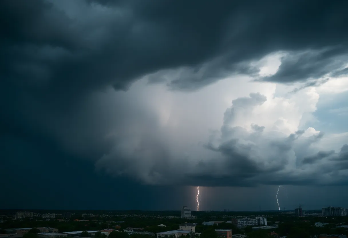
Columbia, South Carolina, is currently facing severe weather with tornado and thunderstorm warnings in effect. A tornado watch has been issued for several counties, including Richland and Lexington, as the National Weather Service tracks the dangerous conditions. Residents should prepare for high winds, potential flooding, and power outages as thunderstorms move through the area. Officials urge everyone to stay informed and safe during this turbulent weather, with alerts expected to remain in effect until Sunday afternoon.
Severe Weather Hits Columbia: Tornado and Thunderstorm Warnings in Effect
Columbia, South Carolina, woke up to a whirlwind of severe weather warnings this Sunday morning, as officials alerted residents to both a tornado warning and a severe thunderstorm warning. It’s been a rocky start to the day as these dangerous conditions loom over the city!
Tornado Warnings Until Morning’s End
The tornado warning shook things up, being active until 8:15 a.m., while the severe thunderstorm warning had a slightly later cutoff time at 8:30 a.m. However, the stormy outlook doesn’t end there—the National Weather Service has indicated that the potential for severe weather will persist through Sunday afternoon, keeping residents on their toes until about 3 p.m.
Widespread Tornado Watch Issued
Thunderstorms and High Winds Expected
Alongside the tornado threats, Columbia residents are facing the possibility of strong-to-severe thunderstorms, which can lead to localized flash flooding and gusty winds. Residents should brace themselves for wind gusts reaching an alarming 60 mph! This isn’t just a light drizzle we’re talking about; the storm could bring significant damage, affecting trees, mobile homes, roofs, outbuildings, and even vehicles. And let’s not forget—downed trees could disrupt power lines, leading to outages. Yikes!
Stay Safe on the Lake
On top of everything, a lake wind advisory is in effect until 8 p.m. for all Midlands areas, with winds reaching 25 mph and gusts possibly hitting 40 mph. If you’re planning a day out on Lake Murray or anywhere nearby, it might be best to rethink those plans for now.
Rain with a Wink of Sunshine Ahead
With a whopping 90% chance of rain slating itself over Columbia, residents should be prepared for rain accumulation of up to a half-inch, with localized amounts potentially exceeding this. In the meantime, let’s hope for some clearer skies! The forecast suggests that conditions will start to dry up and warm up in the next few days. By Wednesday, temperatures may catch a pleasant rise to around 78 degrees. Can you say, “Hello, sunshine!”?
Monitoring the Situation
The National Weather Service remains on high alert, actively monitoring the severe weather situation throughout Columbia and surrounding areas. They will continue to provide updates as new information comes in to ensure that the community stays informed and safe.
In conclusion, when it comes to severe weather, it’s always better to be vigilant and prepared. Stay tuned, stay safe, and take care of one another, Columbia!
Deeper Dive: News & Info About This Topic
- KOMU: Boone County Sirens Sounded
- KMBC: Severe Thunderstorm Watch Issued
- JSONLINE: Tornado Warning Issued Near Madison
- Island Packet: Weather News
- Encyclopedia Britannica: Severe Weather