News Summary
Residents of Columbia, SC are on high alert as severe thunderstorm and tornado warnings have been issued. The warnings are expected to last through the morning, with significant wind gusts and potential for flash flooding. Authorities urge residents to stay informed and prepared as weather conditions can quickly change. Follow safety advisories and ensure emergency kits are ready as storms loom over the area.
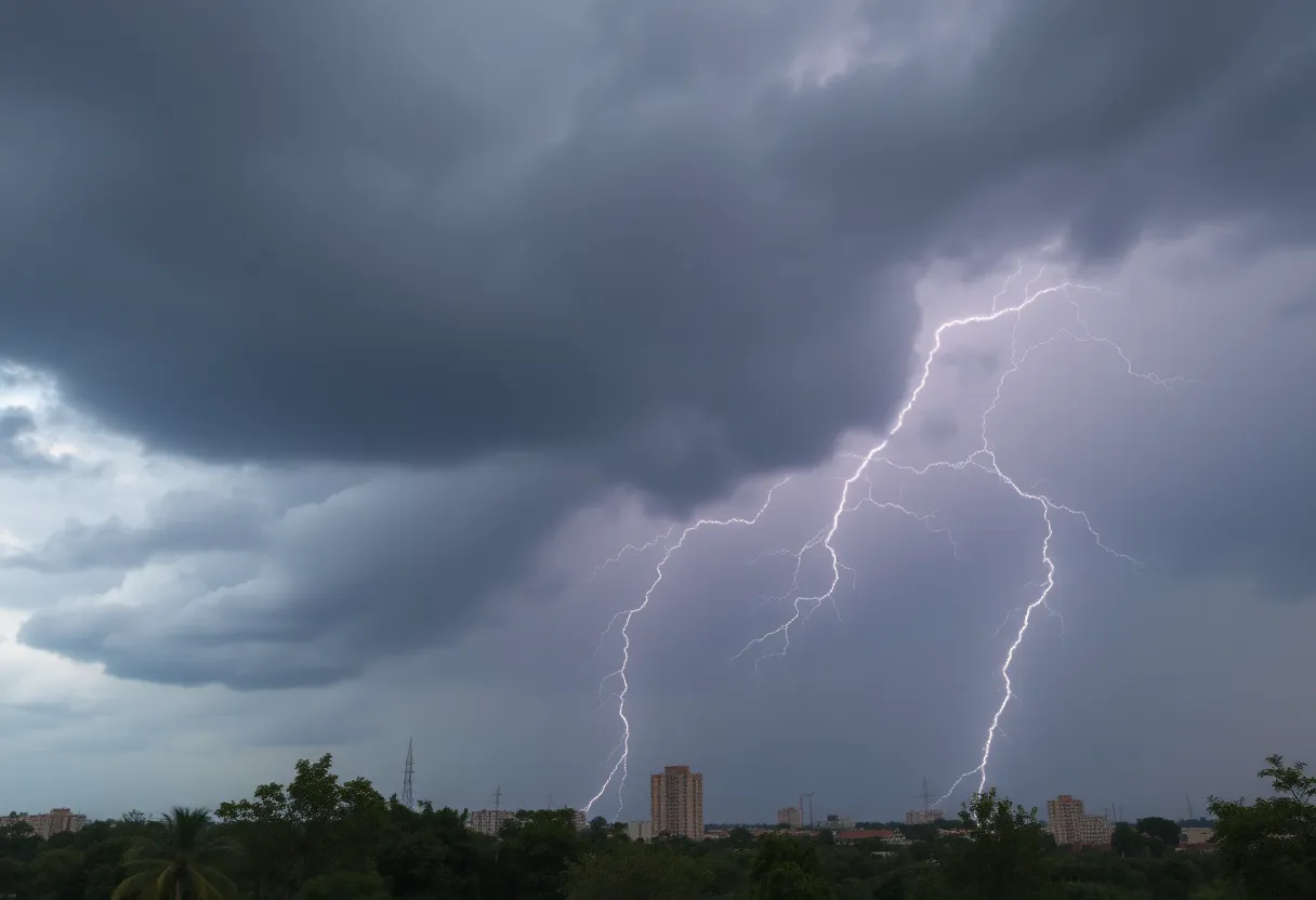
Columbia, SC on High Alert: Severe Thunderstorm and Tornado Warnings Issued!
On a seemingly ordinary Sunday morning, residents of Columbia, South Carolina woke up to unexpected weather alerts that had everyone on their toes. The news came in waves: a severe thunderstorm warning was issued alongside a tornado warning for the area. It’s one of those days when you grab your raincoat and your emergency kit just to be safe!
Timing of Warnings
The tornado warning was in effect until 8:15 a.m., while the severe thunderstorm warning lasted until 8:30 a.m. For those keeping a keen eye on the weather, things were not expected to calm down any time soon. The buzz in the forecasts suggested that severe weather could hang around until the afternoon. Just when everyone thought it might die down, a tornado watch was put into effect until 2 p.m., keeping folks alert and nervous.
A Broad Area of Concern
Richland and Lexington Counties were the heart of the warnings, but the alert spread much further! Almost all counties in the Midlands, including Kershaw, Sumter, Calhoun, Clarendon, Lee, and Orangeburg, found themselves under a tornado watch. It seemed like the weather just wanted to remind everyone who’s boss with higher threats looming, especially for the eastern part of the Midlands.
Spooky Sightings and Gusty Winds
Dreher Island, moving ominously toward the beloved Lake Murray and the dam. As if that wasn’t enough, strong winds were racing through Columbia, with gusts expected to reach up to a whopping 60 mph. Yikes! Those kinds of winds can wreak havoc, uprooting trees, damaging mobile homes, and even tearing up roofs and vehicles. The possibility of scattered debris became a real concern.
More Than Just Tornadoes
All this extreme weather didn’t just bring the tornado warnings; it also held the potential for localized flash flooding—a nasty surprise that comes when the skies open up. Weather forecasts predicted a 90% chance of rain for Columbia, with up to half an inch of rainfall expected. The difficult part? Some areas might even see more than that. Keep those umbrellas handy!
Advisories and Alerts
And for those of you who love lake days, hold onto your life jackets! A lake wind advisory was set for the entire Midlands until 8 p.m. Winds could hit 25 mph, with gusts reaching up to 40 mph. Small craft on local lakes may find themselves in *hazardous conditions*, so skippers may want to think twice before casting off for a day in the sun.
The Silver Lining
Now, let’s not forget; every storm does eventually pass! After the rain and all this ruckus, conditions are expected to dry up and warm up over the next few days. By Wednesday, temperatures could soar up to a pleasant 78 degrees—perfect for enjoying the outdoors! So while the storm may be intimidating now, sunnier skies are just around the corner.
Stay Safe and Stay Informed
In the meantime, residents are urged to keep their ears to the ground and stay tuned for any changing weather conditions. It’s always wise to have multiple ways to receive alerts. As Columbia rides out this stormy chapter, we hope everyone stays safe and well-prepared. Remember, it’s better to be safe than sorry!
Deeper Dive: News & Info About This Topic
- The State: Severe Weather Alerts
- Wikipedia: Tornado Warning
- ABC Columbia: Severe Weather in the Midlands
- WLTX: Southeast Strong Storms
- Cola Daily: West Columbia Closes Parks
- Google Search: Severe Weather Precautions