News Summary
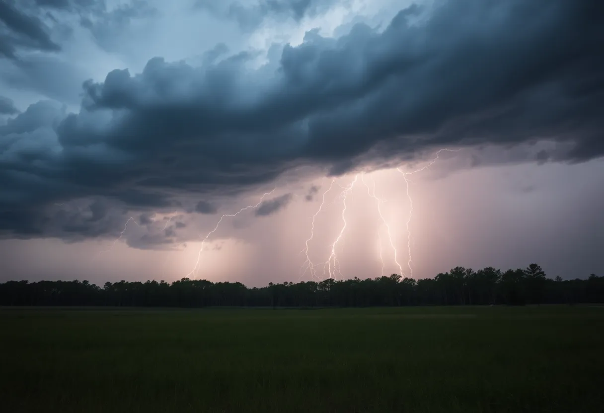
Severe thunderstorms are set to impact Upstate South Carolina, bringing wind gusts up to 60 mph and hail of 0.75 inches. The National Weather Service issued warnings for multiple counties, advising residents to seek shelter. Rain is expected to transition to thunderstorms later in the day, with a high of 92°F. Areas experiencing these storms include Greenville, Spartanburg, and surrounding regions, with reports of severe damage already surfacing. Residents are urged to stay alert for updates and prepare for potential power outages.
Greenville, South Carolina – Severe thunderstorms are forecasted to impact Upstate South Carolina today, bringing with them wind gusts potentially reaching up to 60 mph and hail measurements of up to 0.75 inches. The National Weather Service (NWS) issued a severe thunderstorm warning for multiple counties in the region at 8:12 p.m. on June 17, as meteorologists anticipated the storms to produce dangerous weather conditions.
Rain is expected this morning, transitioning into scattered thunderstorms throughout the afternoon. The high temperature for the day is projected to be 92°F, with winds coming from the west-southwest at speeds between 5 to 10 mph. The probability of rain during the day stands at 60%, with thunderstorms expected to develop further into the evening, before giving way to partly cloudy skies post-midnight. Tonight’s low temperature is expected to be around 72°F, maintaining a similar wind pattern, while the chance of rain persists at 60%.
Counties included in the severe thunderstorm warning are Elbert, Hart, Henderson, Polk, Transylvania, Abbeville, Anderson, Greenville, Oconee, and Pickens. Meteorologists have advised residents to take cover by moving to an interior room on the lowest floor of their homes to ensure safety. They also encouraged community members to report any damaging weather conditions observed.
As of 8:49 p.m. EDT, severe thunderstorms were reported along a line extending from south of Hendersonville to 18 miles southwest of Columbus and seven miles south of Greenville, moving northeast at 50 mph. Radar has indicated wind gust speeds of 60 mph within these storms. Areas at risk for impacts include Greenville Downtown, Spartanburg, Shelby, Gaffney, Laurens, Union, Forest City, Rutherfordton, Columbus, and Greenville’s Eastside.
By 9:18 p.m. EDT, the severe thunderstorms had moved from north of Columbus to southeast of Rutherfordton, continuing to display similar hazardous conditions. A severe thunderstorm warning indicates the possibility of storms producing wind speeds of 58 mph or higher and hail measuring one inch in diameter or larger. Reports emerging from Southern Laurens County have already shown signs of significant damage from the storms, although no tornado activity was noted.
One homeowner reported severe structural damage, including a deck being thrown over a roof and widespread debris scattered throughout the area. The NWS conducted a survey that confirmed extensive property damage attributed to the severe thunderstorms and straight-line winds experienced in the region. This includes impacts to trees, power lines, and other structures, which could lead to additional safety concerns as the storms move through.
Residents are advised to remain alert to weather updates and warnings from local authorities throughout the day and evening, especially given the unstable weather conditions forecasted. The community is also encouraged to be prepared for possible power outages and property damage as these severe thunderstorms pass through Upstate South Carolina.
Deeper Dive: News & Info About This Topic
HERE Resources
Multiple Arrests in Laurens County Related to Rising Crime Rates
Heat Advisory and Severe Thunderstorms in the Carolinas
Laurens County Under Severe Thunderstorm Warning
Extreme Heat Wave Hits the Northeastern U.S.
Laurens Arrests Reveal Diverse Criminal Activities
Clinton Braces for Thunderstorms and 5K Fun Run
Severe Thunderstorms Lead to Widespread Power Outages in Lowcountry
Severe Weather Impacts Millions Across the U.S. This Weekend
Identification of WWII Veteran’s Remains Brings Closure
Clinton High School’s Tre Aiken Commits to NC State
Additional Resources
- Greenville Online: Severe Thunderstorm Warning
- Wikipedia: Thunderstorm
- Island Packet: Severe Thunderstorm Updates
- Google Search: severe thunderstorm South Carolina
- Herald Online: Weather News
- Google Scholar: thunderstorm impact South Carolina
- Myrtle Beach Online: Weather News
- Encyclopedia Britannica: Thunderstorm
- The State: Severe Weather Alerts
- Google News: severe thunderstorm warning